First Alert Weather: Big changes ahead, preparing for first freeze of the season
BIRMINGHAM, Ala. (WBRC) - FIRST ALERT WEATHER DAYS: Our first freeze of the season is expected this weekend. Now is the time to prepare for temperatures near or below freezing. Protect sensitive plants and take steps to winterize as needed. Frost is likely.
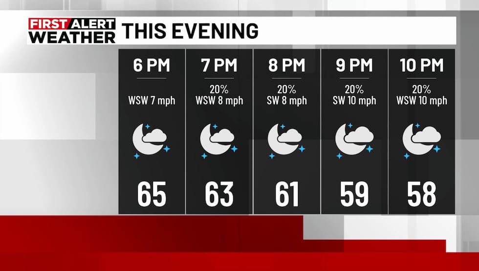
COLD FRONT ARRIVES TONIGHT: Our next cold front arrives tonight, bringing a small chance of rain. A broken line of scattered showers will reach northwest areas by 8 p.m. and move out of southeast areas after midnight. Winds will turn northwest at 10–20 mph through Thursday, with lows tonight in the upper 40s and lower 50s.
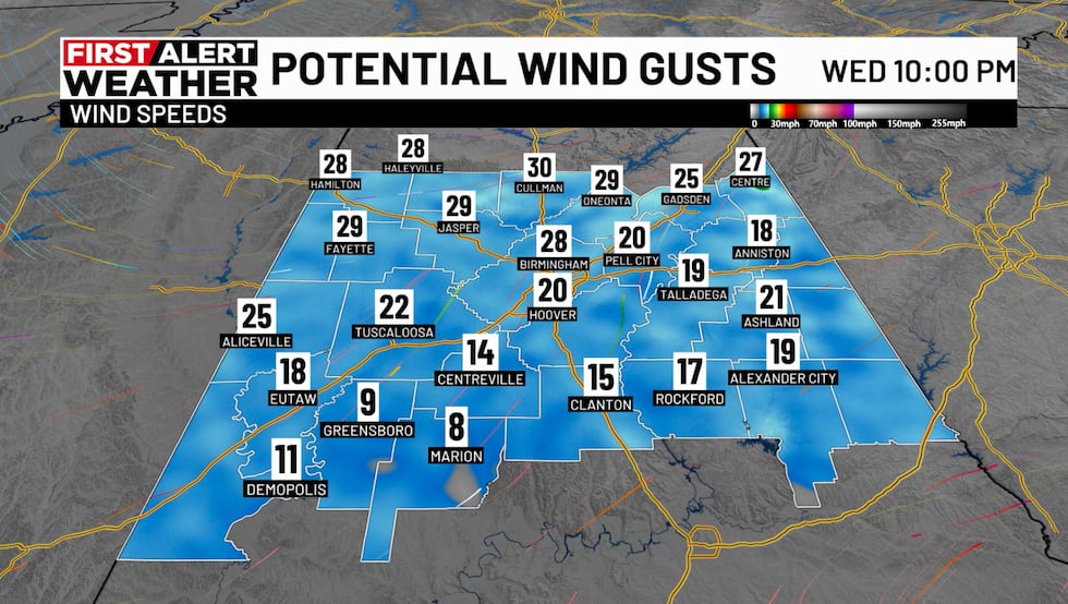
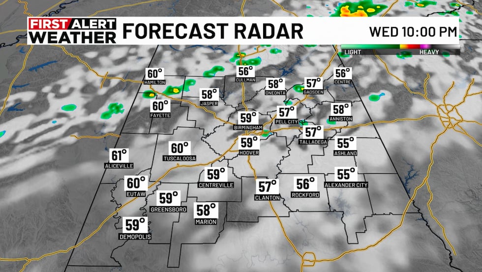
Sunshine returns Thursday, though clouds could increase late in the day as another surge of colder air approaches. A secondary front will cross the state Thursday night, bringing a small chance of a passing shower. Winds could gust over 20 mph as this colder air arrives. Lows will fall into the middle 30s, with wind chills in the 20s Friday morning. The sky will clear Friday, but highs will reach only the lower to middle 50s.
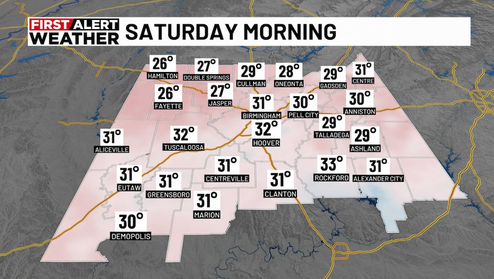
THE WEEKEND: We’ll have our coldest mornings of the season so far this weekend, with lows ranging from the 20s north to near freezing south. Frost is likely Saturday morning. Otherwise, Saturday looks beautiful, with sunshine and highs in the 60s. Plan for more frost and a light freeze Sunday morning. Highs will be near 60° under a mostly sunny sky.
NEXT WEEK: A disturbance in the southern branch of the jet stream could bring a few showers by late Monday, though the greater chance of rain looks to stay closer to the Gulf Coast. Hopefully, the forecast will trend a bit wetter, as we could certainly use the rain. Otherwise, most of the week looks dry.
Guidance continues to signal a strong cold front around the 22nd or 23rd, early in the week of Thanksgiving. It does not appear to bring much wet weather, but it could deliver another significant surge of colder air.
Eventually, this dry pattern should break, but that does not look likely anytime soon. There are subtle signs of El Niño’s influence, with a more active southern branch of the jet stream. A more active pattern often ramps up in late November and December, our second primary severe weather season.
Make sure you download the WBRC First Alert Weather app on Android and Apple devices for the latest weather information.
You can also watch on our free streaming app for Roku, Apple TV and Amazon Fire TV.
Submit your weather photos, videos
Get news alerts in the Apple App Store and Google Play Store or subscribe to our email newsletter here.
Copyright 2026 WBRC. All rights reserved.