First Alert Weather: Freeze threat ahead this weekend
First Alert Weather Days declared for Saturday, Sunday mornings
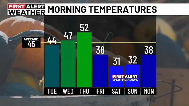
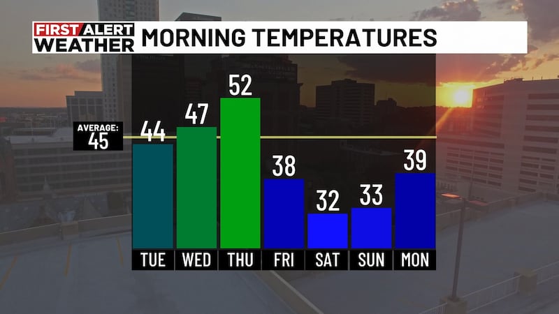
BIRMINGHAM, Ala. (WBRC) - We’ve had our first frost of the season, and another cold front is on the way Thursday. This one will bring even colder air, setting the stage for our first widespread freeze of the season. A first freeze is possible in many areas by Saturday morning, followed by another freeze Sunday morning. We’ve declared both Saturday and Sunday mornings First Alert Weather Days due to the potential for our first freeze.
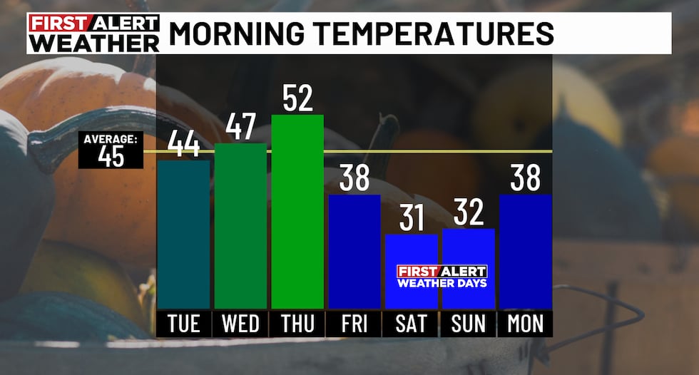
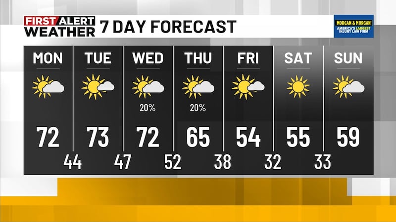
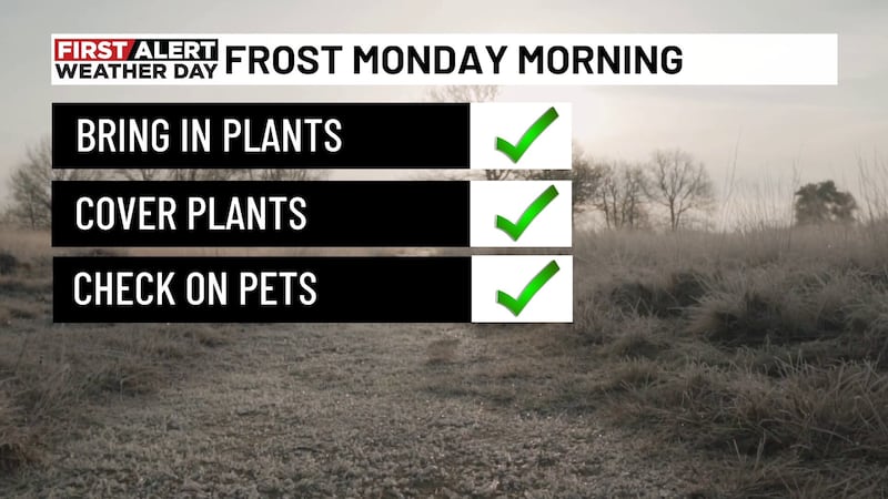
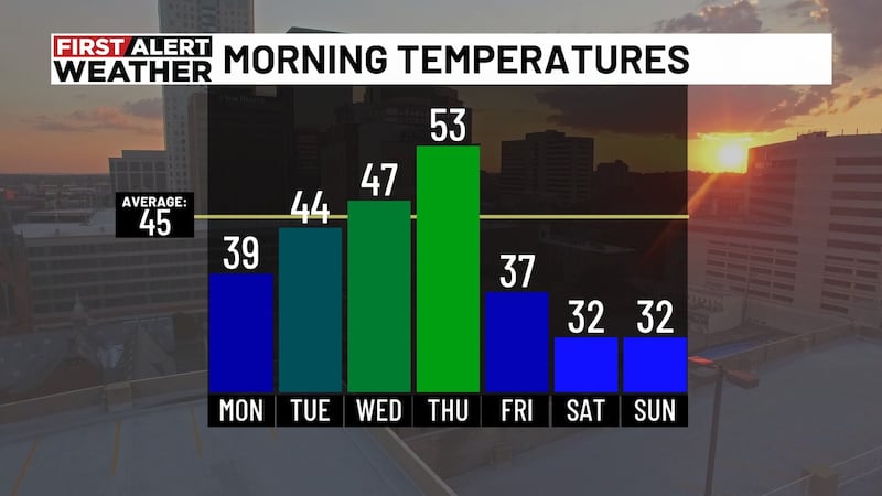
Lows this weekend will range from the upper 20s across the north to near freezing farther south. The days will be quite chilly, too, with highs struggling to reach the middle 50s Friday and Saturday. This is a good time to make final preparations for the colder season ahead and protect any sensitive plants, pets, pipes, and other items vulnerable to near or subfreezing temperatures.
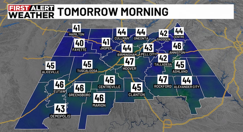
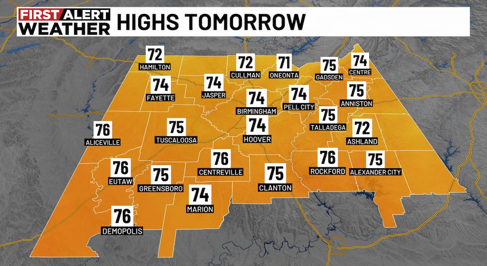
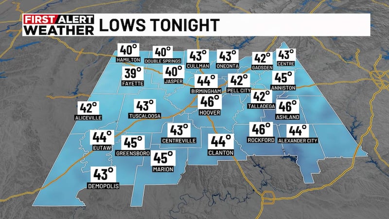
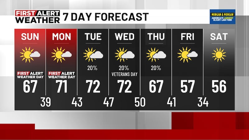
THE NEXT 24 HOURS: Very dry weather continues, and while temperatures will take another big tumble tonight, lows will generally settle into the 40s. Any frost will be more isolated and mainly limited to far northeastern areas. Tuesday will be partly cloudy as some moisture begins to move over the state. This could squeeze out a stray shower or sprinkle across southern areas, but most locations will stay dry. Highs will reach the low 70s, with only a very light westerly breeze at 2-4 mph.
VETERANS DAY: The forecast for Veterans Day looks mostly dry. There is a small chance for a shower early in the morning and again overnight. Highs will reach the low 70s under partly cloudy skies, with a southwest wind at 4-8 mph. Clouds will increase Wednesday night, and it will become quite breezy as our next cold front approaches. A few showers are possible, with a better chance across northern areas. Rain chances should end before sunrise Thursday.
COLDER AIR ARRIVES BEGINNING THURSDAY: Thursday will be blustery, with highs generally in the low 60s. However, some areas across the north may struggle to get out of the 50s as colder air continues to filter in. Northwest winds will increase to 10-20 mph, with higher gusts. Skies will be partly cloudy, but a few low clouds could linger into Friday morning. Lows will fall into the mid to upper 30s, and the breeze will make it feel even colder. Friday afternoon highs will only reach the 50s.
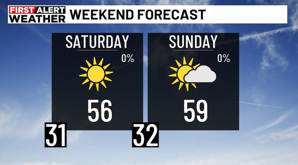
THE WEEKEND: The weekend looks sunny and dry, but much colder. Plan for widespread frost and the potential for a light freeze early Saturday and Sunday mornings. Some areas across the north could start both days in the upper 20s. Highs will only reach around 56° Saturday and 59° Sunday. Some forecast guidance is suggesting a few showers by late next Monday, but for now, we are keeping the forecast partly cloudy. Most of next week looks dry.
Make sure you download the WBRC First Alert Weather app on Android and Apple devices for the latest weather information.
You can also watch on our free streaming app for Roku, Apple TV and Amazon Fire TV.
Submit your weather photos, videos
Get news alerts in the Apple App Store and Google Play Store or subscribe to our email newsletter here.
Copyright 2026 WBRC. All rights reserved.