First Alert Weather Day: Patchy frost until 8 a.m.
BIRMINGHAM, Ala. (WBRC) - Good morning and happy Monday! The First Alert Weather Day continues until 8 a.m. CST for potential frost. Temperatures have cooled into the mid and upper 30s along and north of I-20. It’s slightly warmer south of I-20 in the upper 30s and lower 40s. If you see any frost, let us know! Take some pictures and submit them through the WBRC First Alert Weather App. We would love to share your pictures on WBRC 6 News and on social media. Patchy fog can’t be ruled out near bodies of water before 8 a.m. CST.
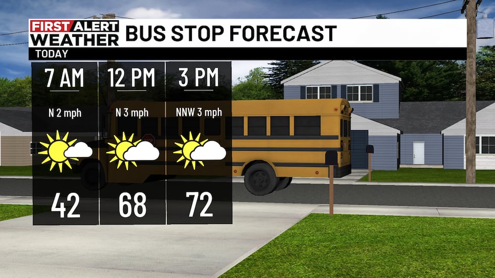
We are looking at a beautiful fall day. We should end up mostly sunny to partly cloudy today with high temperatures climbing into the lower 70s. Winds should continue from the north at 5-10 mph. You may not need a jacket this afternoon, but I recommend one this evening if you plan to be outside. Temperatures will likely cool into the mid 50s by 7 p.m. CST. Frost should not be a major concern tonight.
Beautiful Tuesday: Temperatures tomorrow morning will likely trend slightly warmer, but it will remain chilly with most of us cooling down into the low to mid 40s. We will likely end up partly cloudy tomorrow afternoon with high temperatures in the lower 70s. A weak disturbance could give us some extra clouds tomorrow, but odds of seeing any rain developing remains very low and unlikely. Winds will remain light tomorrow from the northwest at 5-10 mph.
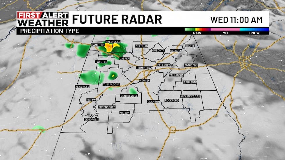
Isolated shower for Veterans Day: Temperatures will likely start out in the mid and upper 40s Wednesday morning. A weak disturbance could produce isolated showers across central Alabama Wednesday morning. I think we will remain mostly dry Wednesday afternoon with highs in the lower 70s. A strong cold front is forecast to move through the state Wednesday night into Thursday morning. A few showers will be possible during this time frame. Rainfall totals will likely remain low with just a tenth of an inch or less for areas north of I-20.
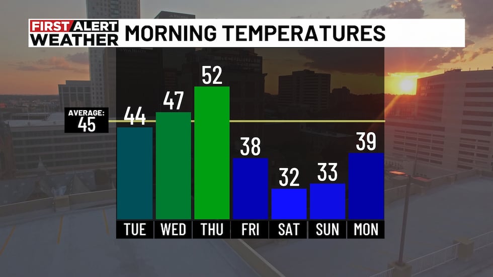
Next Big Thing: We want to give you a first alert for a very strong cold front impacting our area Thursday and Friday. We could see showers develop Wednesday night into early Thursday morning ahead of a cold front. Temperatures will likely start out in the lower 50s Thursday morning. Thursday afternoon is shaping up to be partly sunny and breezy as dry air moves into Alabama. We may see temperatures briefly warm into the mid 60s Thursday afternoon. Winds could be gusting up to 25-30 mph. Cold air moving into Alabama will allow temperatures to cool into the upper 30s Friday morning. We are looking at temperatures 10-15 degrees below average Friday through the weekend. We could see afternoon highs in the mid 50s with overnight lows near freezing. We will likely have to issue First Alert Weather Days Saturday and Sunday morning for the first freeze of the season. Overnight lows could drop into the upper 20s and lower 30s.
Make sure you download the WBRC First Alert Weather app on Android and Apple devices for the latest weather information.
You can also watch on our free streaming app for Roku, Apple TV and Amazon Fire TV.
Submit your weather photos, videos
Get news alerts in the Apple App Store and Google Play Store or subscribe to our email newsletter here.
Copyright 2026 WBRC. All rights reserved.