First Alert Weather Day: Frost returns Monday morning, more cold air ahead
BIRMINGHAM, Ala. (WBRC) - Hi all!
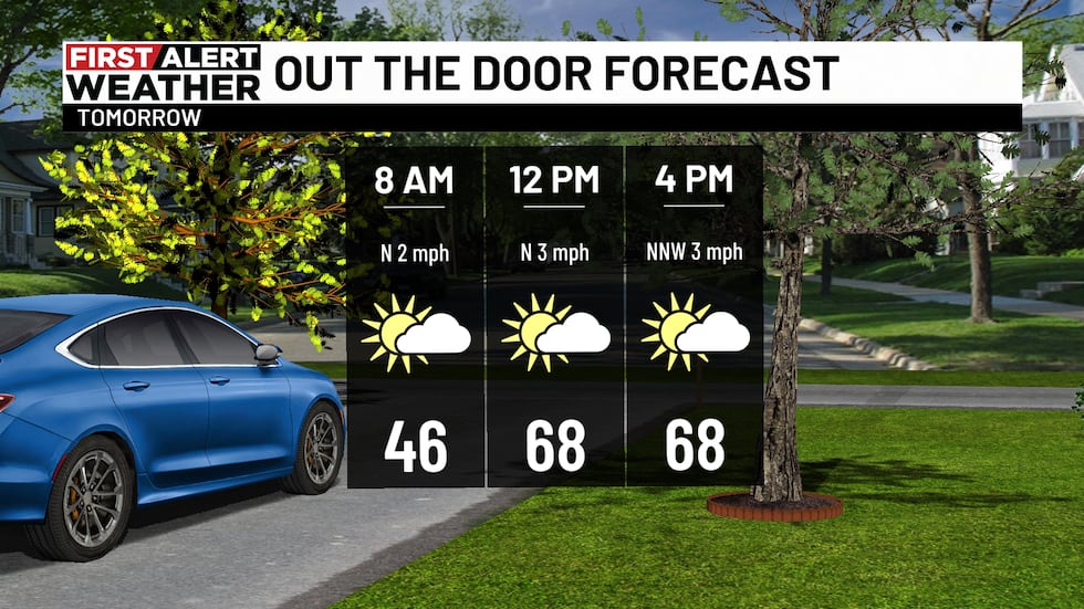
TONIGHT: I hope everyone was able to enjoy the fall day we had today! We’re trading these comfortable conditions for some chilly temperatures again overnight tonight. Many of us are already in the upper 40s and low 50s. I’d definitely grab a jacket if you’re heading out tonight! We’ll stay dry overnight with mostly clear skies, which will let those temperatures fall into the 30s by early tomorrow morning.
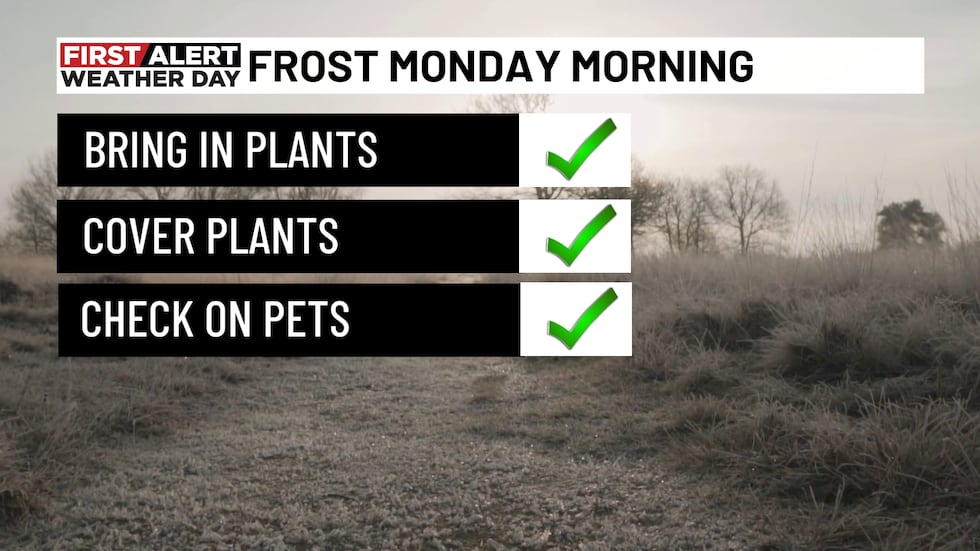
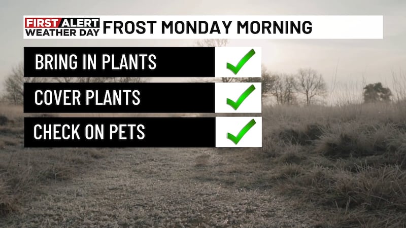
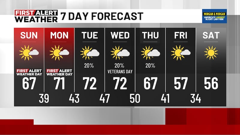
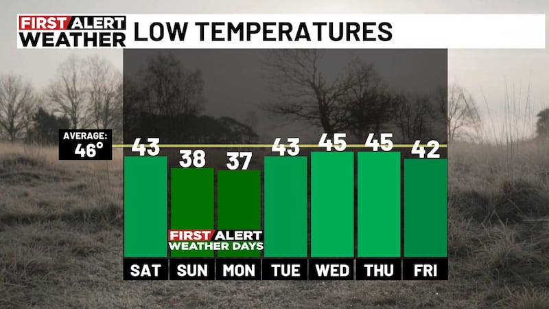
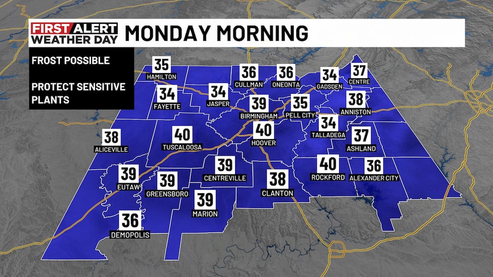
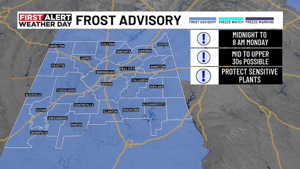
FIRST ALERT WEATHER DAY: We’re keeping our First Alert Weather Day in place from midnight tonight through 8 am tomorrow (Monday) as another round of frost develops across Central Alabama! The National Weather Service has issued a Frost Advisory for ALL of Central Alabama, with temperatures dropping into the mid to upper 30s overnight. Some of our colder spots could get near freezing! The greatest frost potential will be for our northern counties, but patchy frost is possible pretty much anywhere in the area. If you’ve got sensitive plants outside, make sure you’re bringing them indoors or covering them up before you head to bed tonight! I’d also make sure your outdoor pets have a warm place to stay. The good news? Once we get past that frosty start, Monday is shaping up to be a beautiful fall afternoon with lots of sunshine and highs in the low 70s!
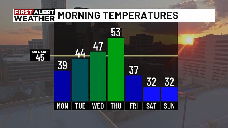
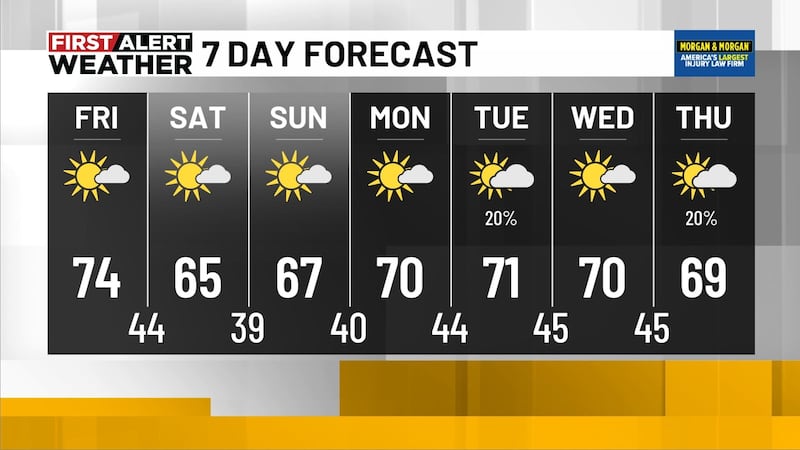
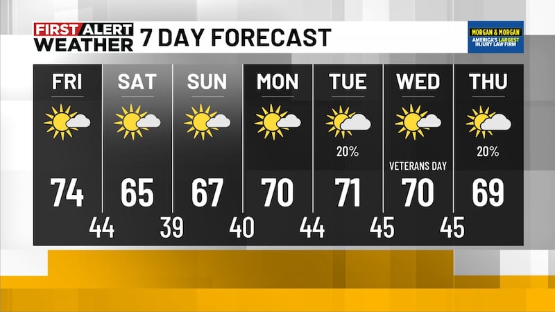
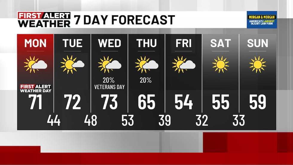
NEXT 48 HOURS: The conditions and temperatures to start out your workweek look pretty nice! Monday and Tuesday we’ll see lots of sunshine with highs reaching the low 70s again. We’ll still see some chilly mornings, but not as cold as what we’ve seen the past 48 hours! Most of us will wake up Tuesday and Wednesday in the 40s. Outdoor plans this week should be good to go! Enjoy the comfortable afternoons while they’re here because we’ve got a BIG temperature change coming our way!
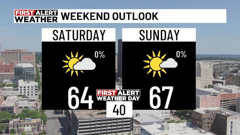
THIS WEEK: As I mentioned above, don’t get too comfortable with those 70s! We’re tracking what could be our coldest air of the season arriving later this week. We’ll stay dry through Wednesday afternoon before a weak upper-level disturbance brings a small chance for a few showers late Wednesday into Thursday. The bigger story arrives by Thursday as a strong cold front moves through the Southeast. Temperatures will take a tumble behind it, with highs struggling to get out of the 50s by next weekend! Here’s what really has my attention with this: next weekend could bring our first widespread freeze of the season! Morning lows could drop into the low to mid-30s, with afternoon highs staying well below average. We’re still several days away, so we’ll continue to fine-tune those temperatures!
Have a great Sunday evening everyone!
Make sure you download the WBRC First Alert Weather app on Android and Apple devices for the latest weather information.
You can also watch on our free streaming app for Roku, Apple TV and Amazon Fire TV.
Have a great Sunday!
Submit your weather photos, videos
Get news alerts in the Apple App Store and Google Play Store or subscribe to our email newsletter here.
Copyright 2026 WBRC. All rights reserved.