First Alert Weather: Cool, dry weekend; frost possible Saturday night
BIRMINGHAM, Ala. (WBRC) - Good morning and happy Saturday!
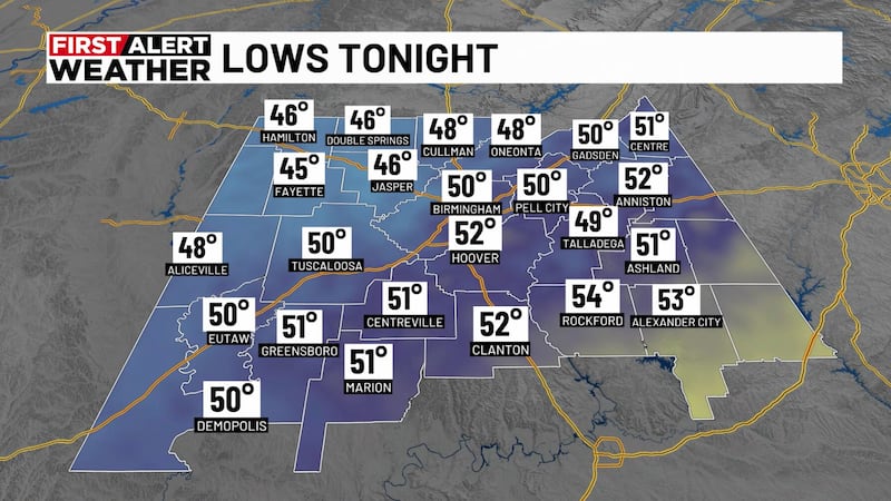
We want to give you a First Alert for cooler temperatures this weekend. We are waking up with temperatures in the mid- and upper 40s. When you factor in a light wind, it could feel a few degrees cooler.
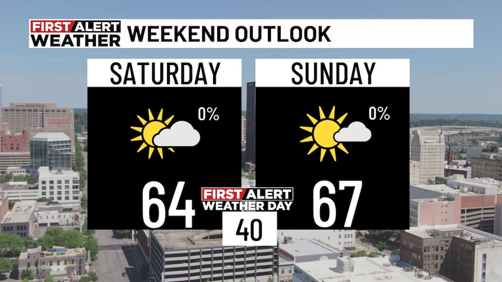
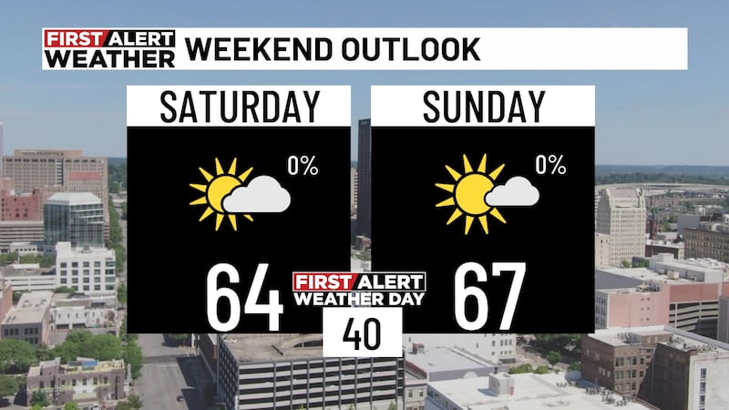
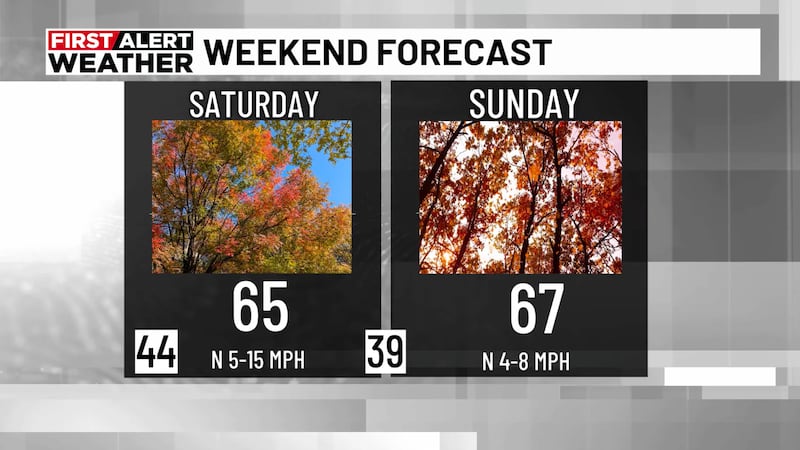
If you plan to be outside today, make sure you hold on to the jacket. You’ll likely need it throughout the day as temperatures only warm into the low-to-mid-60s. We are looking at a partly cloudy sky with hazy sunshine possible at times as upper-level clouds roll through the area today. We will remain dry with northerly winds at 10-15 mph.
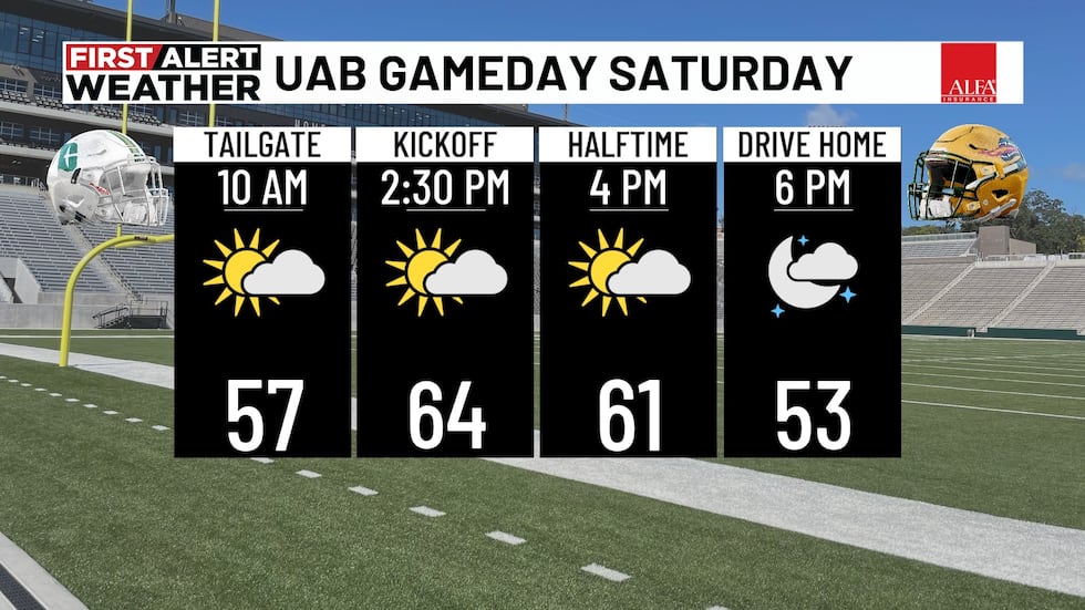
Football forecasts: The weather should be beautiful for the UAB and Auburn games today. If you are attending the Jacksonville State game this evening, you’ll want to bundle up and perhaps wear gloves. Temperatures will likely cool into the 50s and 40s late this evening with a partly cloudy sky.
Alabama travels to Baton Rouge to take on the LSU Tigers at 2:30 p.m. It should be a beautiful afternoon with a partly cloudy sky. Temperatures at kickoff in the low-to-mid-70s.

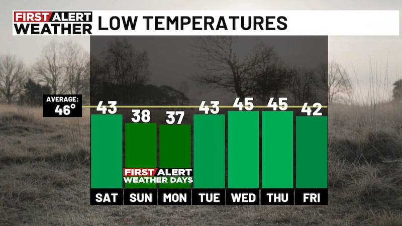
First Alert Weather Days for Sunday and Monday: We want to give you a First Alert for frost Sunday morning and Monday morning. First Alert Weather Days for Sunday and Monday: We want to give you a First Alert for frost Sunday morning and Monday morning. Since it is the first big frost potential of the season, we have declared both days as First Alert Weather Days. This is mainly concerning agriculture and plants. We are moving away from the warm season and approaching the cold season. If you have any sensitive plants, you may want to cover them up or bring them indoors this afternoon. I also recommend that that your pets also have a way to stay warm too!
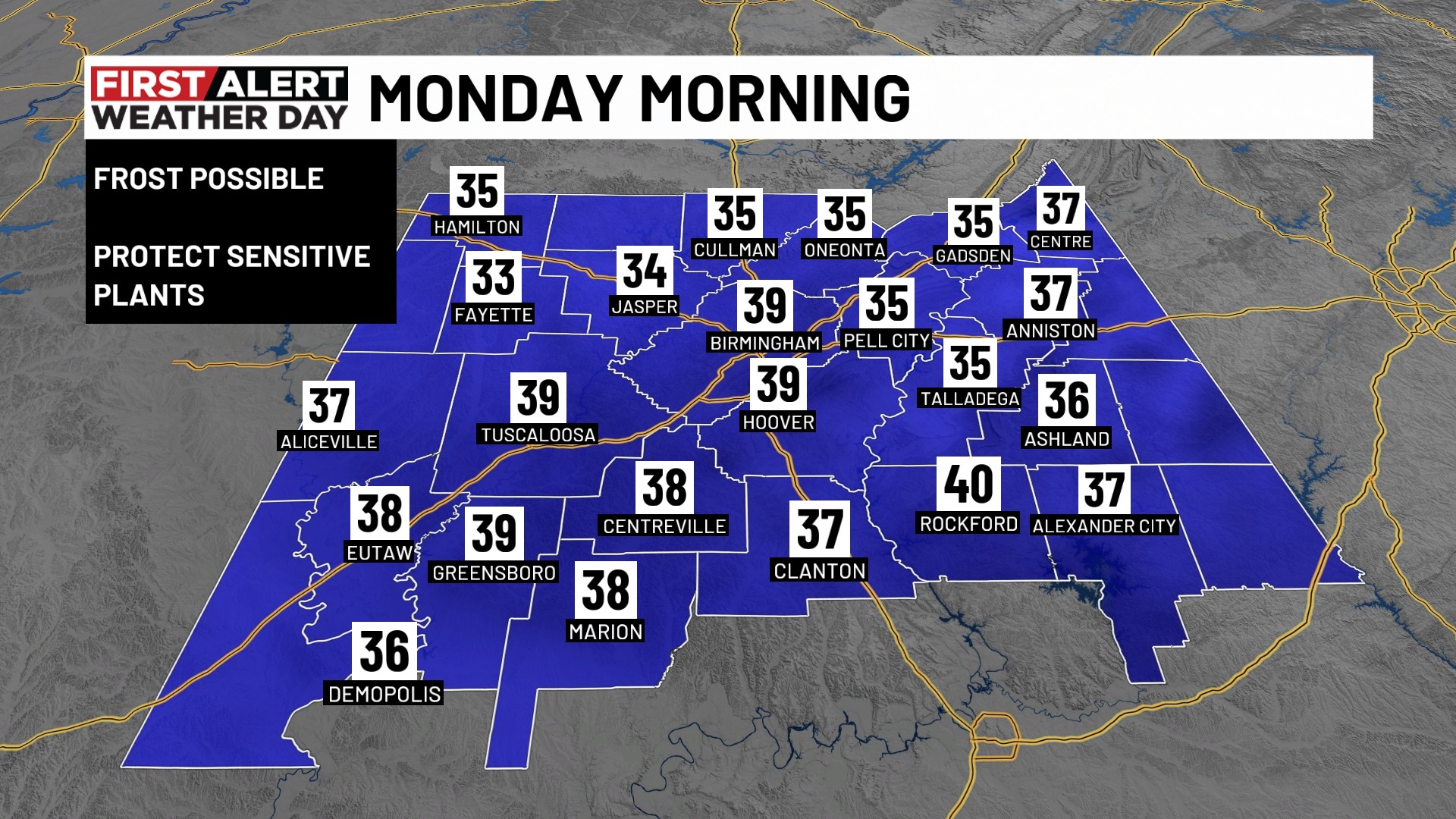
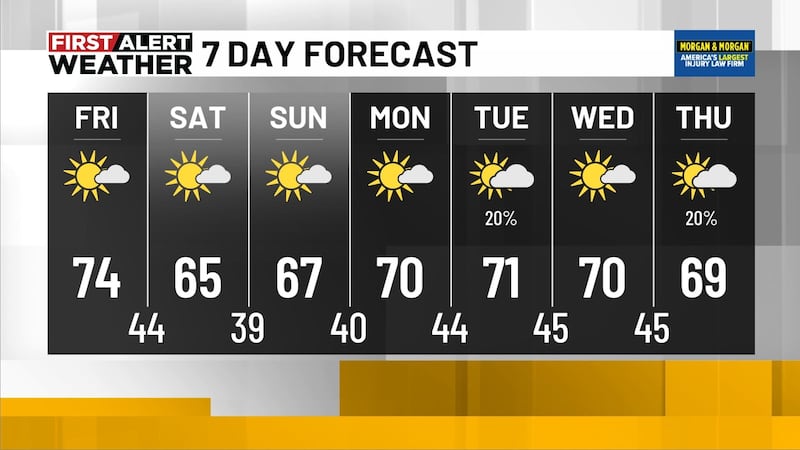
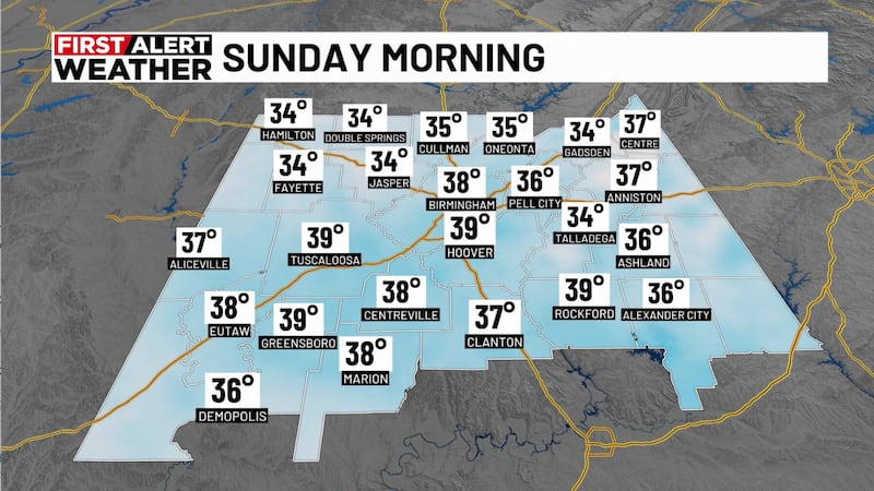
Temperatures are forecast to cool into the upper 30s and lower 40s Sunday morning. Mid-30s can’t be ruled out in north Alabama. Monday morning may trend a few degrees cooler with lows in the mid- and upper 30s. Frost potential appears greater for Monday morning. The National Weather Service has not issued any frost advisories yet, but that could change over the next 12-24 hours.
Sunday afternoon will likely trend partly cloudy to mostly sunny with highs in the mid and upper 60s. It won’t be as breezy tomorrow afternoon with north winds at 5-10 mph.
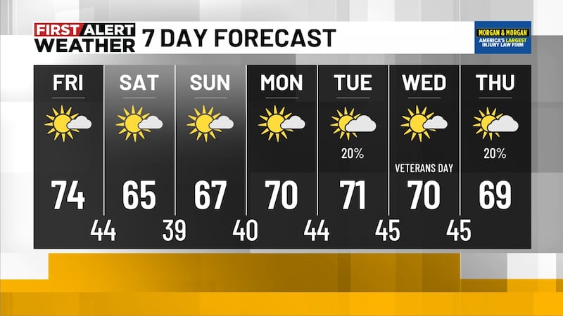
Slightly warmer early next week: We will likely see temperatures trend a little warmer for the first half of next week. Afternoon temperatures may warm into the lower 70s Monday, Tuesday and Wednesday.
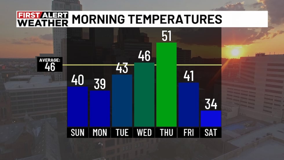
We will likely deal with cool temperatures in the morning hours with lows in the 40s. We will likely remain dry for the first half of the week, but we can’t rule out some isolated showers as a weak disturbance move along the Gulf Coast Tuesday night into Veterans Day. A brief shower is possible Tuesday night into Wednesday morning, but the majority of us will likely remain dry with a partly to mostly cloudy sky.
Colder air possible next weekend: Long-range models continue to show the coldest air (so far) of the season moving into the Southeast by the end of next week.
We could squeeze out a brief shower behind another cold front Wednesday night into Thursday morning. Colder air will likely return Thursday afternoon and cool us down into the lower 40s next Friday morning. We may only see high temperatures climb into the upper 50s next Friday and Saturday.
Next weekend could produce our first big freeze of the season too! Morning lows could drop into the low-to-mid-30s next Saturday and Sunday morning. If this forecast holds true, we may have to issue First Alert Weather Days for freezing temperatures for the weekend of November 14-15, 2026.
Make sure you download the WBRC First Alert Weather app on Android and Apple devices for the latest weather information.
You can also watch on our free streaming app for Roku, Apple TV and Amazon Fire TV.
Have a wonderful weekend!
Submit your weather photos, videos
Get news alerts in the Apple App Store and Google Play Store or subscribe to our email newsletter here.
Copyright 2026 WBRC. All rights reserved.