First Alert Weather: Off-and-on rounds of storms possible this weekend
BIRMINGHAM, Ala. (WBRC) - First Alert AccuTrack shows strong to severe storms moving across west-central Alabama and moving south and east. A Severe Thunderstorm Watch is in effect until midnight in our counties to the south and west (Bibb, Tuscaloosa, Pickens, Sumter, Greene, and Hale). Even as these storms wane overnight, off-and-on rounds of storms will be possible over the weekend with the potential to produce damaging winds, large hail, heavy downpours, and intense lightning. So, the pesky, unsettled northwest flow pattern continues!
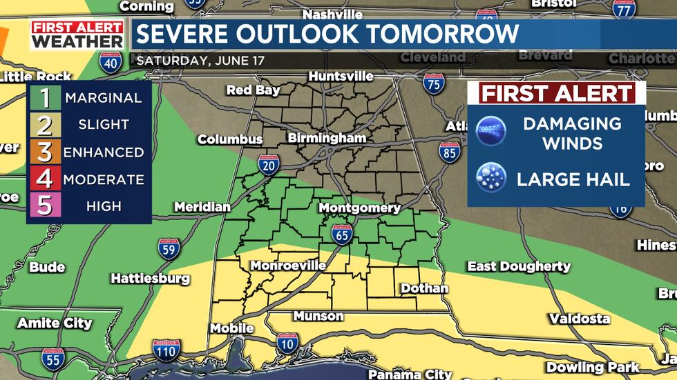
Father’s Day Weekend: Once again, off-and-on rounds of storms will be possible on Saturday and Sunday. Unfortunately, with this type of pattern in place, forecasting the timing of these rounds of storms is tricky. Likely the best chance to see storms will be in our southwest counties, along the I-20 corridor west of I-65. We will likely start off tomorrow and Sunday muggy and warm with patchy fog possible in addition to isolated showers and storms. When any storms aren’t around, expect hot and muggy conditions each afternoon with highs in the upper 80s and low 90s but the humidity making it feel like the mid to upper 90s. Rain coverage is around 50% for Saturday and 30% for Sunday.
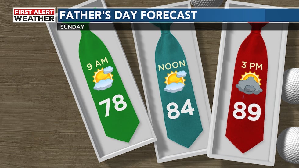
Stormy Juneteenth: Monday is unfortunately trending stormy across Central Alabama. We’ll have a disturbance approach us giving us rounds of showers and storms. Severe weather can’t be ruled out with the risk of damaging winds and large hail. We are forecasting a mostly cloudy sky with a 70% chance for storms. Highs are forecast to remain below average with most of us in the low to mid 80s. Monday morning could be wet and stormy, so make sure you tune in to Good Day Alabama for updates.
Unsettled Weather Next Week: The stormy pattern will likely continue for most of next week. Rain chances remain elevated at 50-60% Tuesday and Wednesday. Rounds of storms will likely remain across the Southeast. High temperatures are forecast to climb into the low to mid 80s. We could pick up an additional 2-3 inches across Central Alabama over the next 5-7 days. I’m hoping we can trend a little drier by the end of next week.
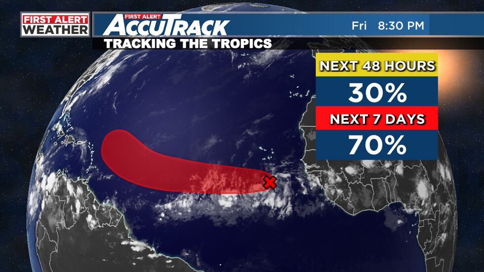
Tropical Update: We are monitoring a weak area of low pressure that just moved off the African coast. Sea surface temperatures are unusually warm for June standards, and there’s increasing odds that this system could develop into a tropical depression or storm within the next several days days. The National Hurricane Center is giving this system a 70% chance to develop. It’s very odd to see tropical systems form in the deep Atlantic Ocean in June. Normally, conditions are unfavorable thanks to dry air and cooler sea surface temperatures. We normally see tropical activity ramp up in this part of the Atlantic in August and September. Models do show development, so we’ll have to watch it. No signs as of now if it will impact the United States.
Make sure you download the WBRC First Alert Weather app for the latest weather information.
Get news alerts in the Apple App Store and Google Play Store or subscribe to our email newsletter here.
Copyright 2023 WBRC. All rights reserved.