First Alert Weather: Few thunderstorms possible overnight
BIRMINGHAM, Ala. (WBRC) - First Alert AccuTrack shows a few dissipating thundershowers moving southeast across Central Alabama this evening. Though coverage should be fairly isolated and the severe threat remains very low, any storm around tonight will be capable of producing heavy rain, lightning, gusty winds, and small hail. Otherwise, expect a partly cloudy sky with west winds becoming calm overnight. Patchy fog could develop after midnight, but we do not expect issues for the morning commute.
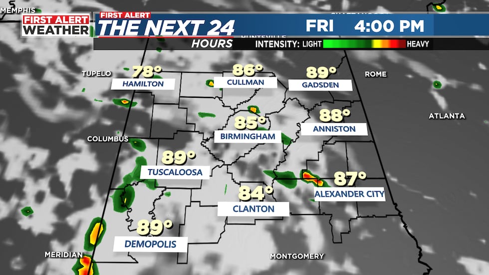
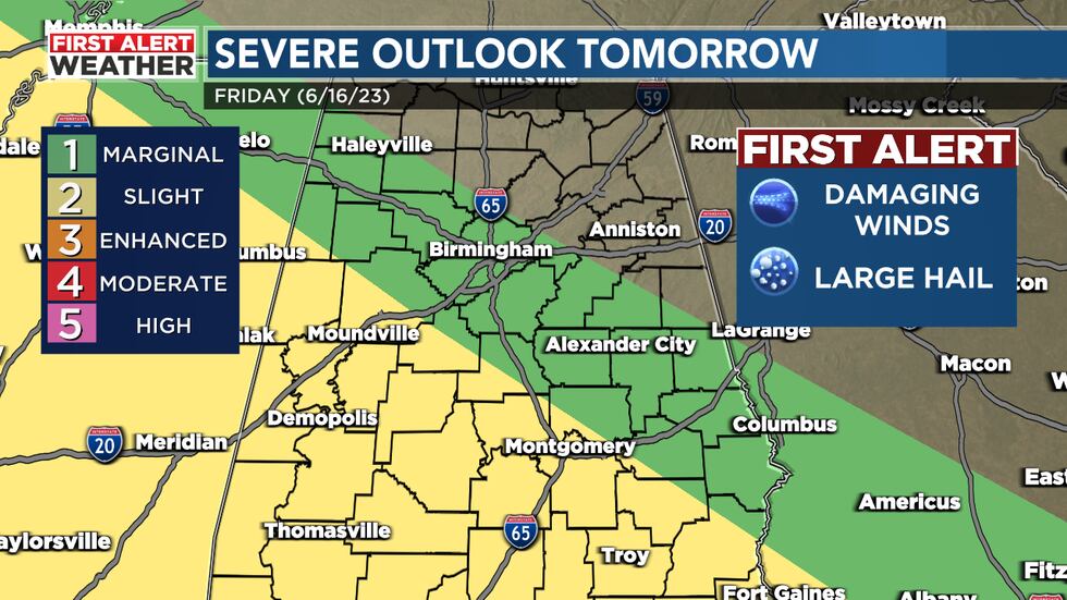
Widely Scattered Storms Possible Friday: We will continue to watch a conveyor belt of moisture push into the Southeast tomorrow. We will likely watch another cluster of storms push into Arkansas and Mississippi tonight. There’s a chance this cluster of storms could clip parts of southwest Alabama Friday morning. The Storm Prediction Center has a slight risk - threat level 2 out of 5 - for parts of Pickens, Sumter, Greene, Hale, Bibb, Tuscaloosa, and Chilton Counties. The main threats will be damaging winds and large hail. Rain coverage as a whole will remain widely scattered tomorrow at 30-40%. High temperatures are forecast to heat up into the upper 80s with a partly sunny sky. Winds will continue from the west-northwest at 5-10 mph.
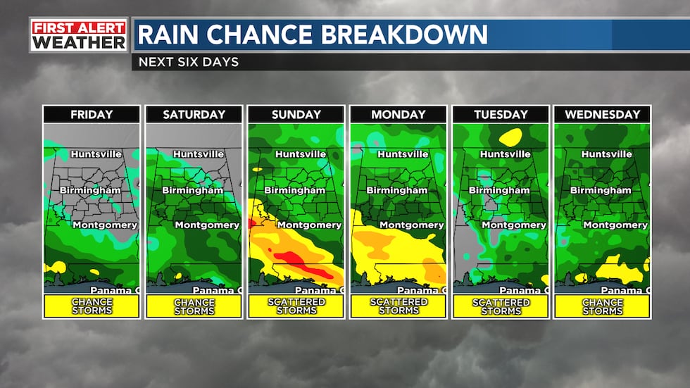
Hot Saturday: If you have any outdoor plans Saturday, you’ll want to stay hydrated and continue to monitor the weather. We will likely start the weekend out mostly dry with temperatures in the upper 60s Saturday morning. We will hold on to a 30% chance for pop-up showers and storms with highs approaching 90°F. When you factor in the humidity, it could feel like it is in the mid to upper 90s. We will have to watch for stormy weather to our west, but models are trending drier with most of the activity staying away from us.
Father’s Day Forecast: The active weather pattern will likely ramp up across the Southeast as we approach Father’s Day and Juneteenth. Northwest flow will continue to bring clusters of storms into parts of the Southeast Sunday and Monday. With plenty of upper-level energy and instability, storms will have another chance to become strong and severe. I would definitely have ways to receive warnings Sunday, Sunday night, and into Monday. The Storm Prediction Center has already issued a Day 4 outlook for Sunday for the threat for damaging winds and large hail across northwest Alabama. Timing could change between now and Sunday, but it’s looking like a Sunday evening, Sunday night, and Monday morning event. High temperatures are forecast to heat up into the mid to upper 80s Sunday afternoon with a 60% chance for storms.
Unsettled Weather Continues Next Week: We will continue to monitor rounds of showers and storms next week. We have a 60% chance for stormy weather on Juneteenth. Rain chances will likely remain scattered through at least next Wednesday with highs in the mid 80s. There’s a chance that this pattern will break by the end of next week. It will likely result in hotter temperatures and lower rain chances. I have highs in the lower 90s with isolated storm chances by NEXT weekend.
Make sure you download the WBRC First Alert Weather App for the latest weather information.
Get news alerts in the Apple App Store and Google Play Store or subscribe to our email newsletter here.
Copyright 2023 WBRC. All rights reserved.