First Alert Weather: Strong storms possible at times on Saturday
BIRMINGHAM, Ala. (WBRC) - First Alert AccuTrack looks fairly quiet this evening with rain chances staying low through the overnight hours. Though we’re enjoying a partly cloudy sky for now, more clouds will build back in tomorrow morning.
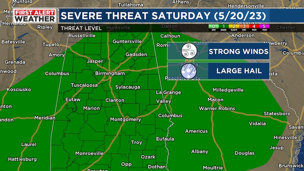
Next Big Thing: The big story this weekend is the arrival of a cold front that will push through Central Alabama. Tomorrow morning will start off cloudy and mild with showers and a few storms moving into northwest Alabama by mid-morning. I would recommend having the umbrella and rain jacket nearby if you plan on being out tomorrow. We will hold on to a 60% chance for scattered showers and thunderstorms. Temperatures will likely start out in the mid 60s tomorrow morning and heat up into the lower 80s Saturday afternoon. The Storm Prediction Center is highlighting a marginal risk - threat level 1 out of 5 - for the threat to see strong winds and large hail. We could see a few strong or severe storms, but I think most of us will end up seeing pockets of heavy rain and lightning. Remember, when thunder roars, go indoors! We will also have to watch for the threat for isolated flash flooding. A few storms could produce 1-3 inches of rain in an hour. I think the best chance to see rain tomorrow will likely occur between 8 a.m. - 8 p.m. We will trend drier Saturday night.
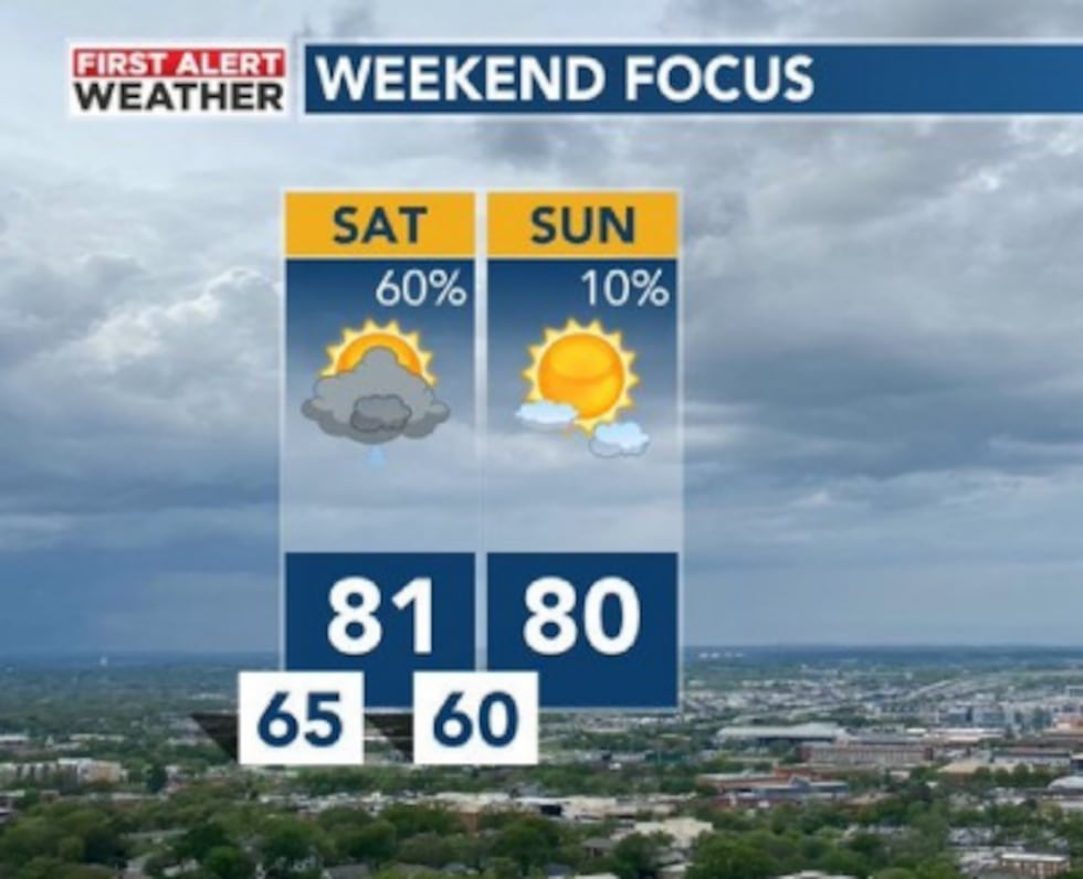
Isolated Showers Still Possible Sunday: The big change in the forecast is adding a rain chance for early next week. Some of our weather models are hinting that the cold front that moves through our area tomorrow could stall across the southern half of the state. We could see thundershowers develop again Sunday afternoon for areas south of I-20 and east of I-65. Confidence on our rain chances remains low, but it’s worth adding a 20% chance in our forecast. I think areas north and west of Birmingham will likely remain dry Sunday afternoon. If models trend wetter, we will let you know. I would plan for a partly sunny sky Sunday. Morning temperatures are forecast to start out in the low 60s with highs approaching 80°F.
Complicated Forecast Next Week: Long-range weather models are showing easterly flow setting up across the Southeast next week. Easterly flow could bring weak disturbances into the area giving us additional rain chances. It will also keep our temperatures at or slightly below average for late May. Confidence remains low on the placement and coverage of rain for early next week, but I decided to increase our rain chance to 40% for next Monday. There’s a chance Monday could end up wetter, so make sure you’re keeping up to date on WBRC and the First Alert Weather app over the weekend. Isolated showers will be possible each day next week. I would plan for a partly to mostly cloudy sky next week with highs near 80°F and lows near 60°F.
Make sure you download the WBRC First Alert Weather App for the latest weather information.
Get news alerts in the Apple App Store and Google Play Store or subscribe to our email newsletter here.
Copyright 2023 WBRC. All rights reserved.