First Alert Weather: Scattered storms likely again for Tuesday afternoon
BIRMINGHAM, Ala. (WBRC) - The remaining storms and showers on radar tonight are impacting far south and southeast areas. We could see some dense fog in parts of the area for the morning drive. Otherwise, expect a very similar start to the today, with rapidly building heat. Highs for Tuesday will reach the upper 80s, with the humidity levels pushing the heat index above 90º.
FIRST ALERT FOR MORE STORMS: Be alert for more scattered thunderstorms Tuesday afternoon. Some storms may be very strong, with gusty winds, intense lightning, and hail. The chance for showers and storms will continue late into the evening and I can’t rule out some lingering showers into the early morning on Wednesday.
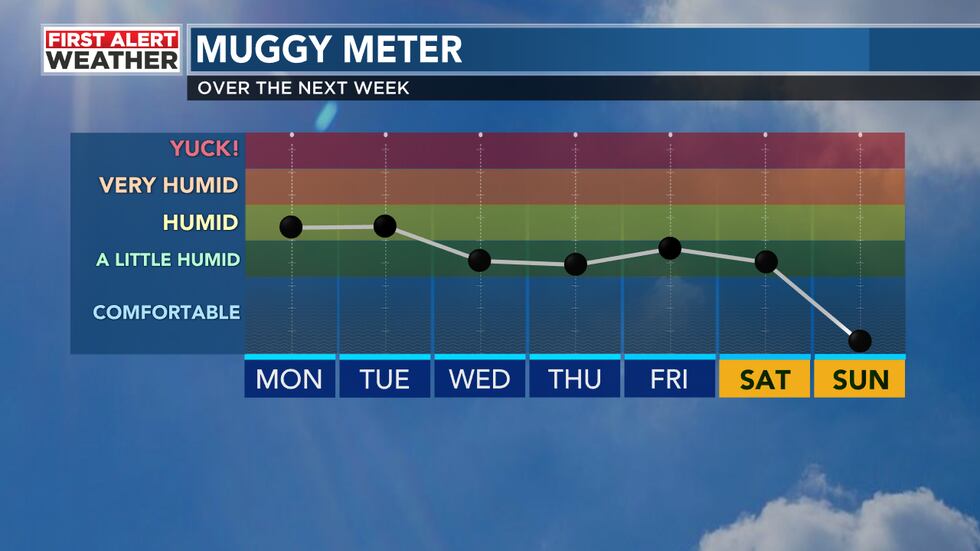
THE NEXT BIG THING will be a slight drop in the muggy levels for the second half of the workweek. I still can’t rule out a few pop-up storms and showers for Wednesday, Thursday, and Friday. However, the coverage will become more isolated, with highs in the low 80s. We will see another slight increase in scattered storms for Saturday and then an even drier air mass could settle in on Sunday. This will be quite noticeable at night, with lows in the 50s.
Get news alerts in the Apple App Store and Google Play Store or subscribe to our email newsletter here.
Copyright 2023 WBRC. All rights reserved.